Thursday 29 July 2021

Ragged Jack Rd.

Will leave the Tamar River for the time being, and return to it next week.

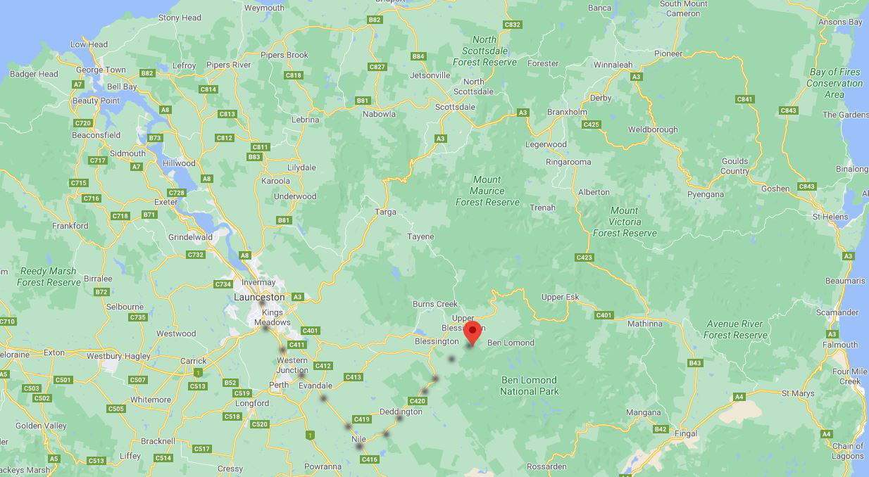
A couple of weekends ago on a Saturday my husband and I set of for a drive, so I packed some lunch and we headed off out past the Launceston Airport, through Evandale, Nile, Deddington, Upper Blessington, then home - see map below.

Deddington is a small town with no shops and just a few houses.  Years ago there was a lovely old Hotel/Pub that accidentally burnt down never to be rebuilt.. When much younger though having my degree we along some other Dr.'s and nurses and various other staff at the hospital headed to Deddington many Sunday afternoons where the men would play billiards and we women would watch by the big open fire. Much laughing was done away from work where no one knew any of us.

The first photo is of the Nile River, then next to that is a gateway so we parked there to eat our lunch then headed off till be came to a gravel road which we detoured on.  We went along this forest road where plantations of trees were so we figured it was a logging track.  There were pot holes rather deep but husband kept going, roads off roads and so on.  We saw mountains and discovered one of them was Ragged Jack so therefore we were on Ragged Jack Road.  It went for miles/klms. 
The photos show the road as being a bit wide but that wasn't the case as we travelled along.


Ragged Jack Road, Upper Blessington map.

Monday 26 July 2021

North of Hillwood

A little regarding the Tamar River here in Launceston, Tasmania, Australia.
The Tamar River is a 70 kilometer estuary located in northern area of the Island Tasmania.  Despite being called a river, the waterway is a brackish and tidal estuary over it's entire length.
Some photos taken near Hillwood and north of with my Canon DSLR camera. 
The first photo is the bridge which we drove over on the other side, the Western side. 
Last photo you can see the Batman Bridge which we drove over after going to George Town on the Eastern side.


Friday 23 July 2021

Down Hillwood Way

More photos from another place along the Tamar River here in Launceston, Tasmania Australia.
This area is at Hillwood where many, many strawberries are grown and other fruit in summer.
Discovered this little beach, yes that's sand believe it or not in the first photo. It's amazing how clean the river is at this point.


Tuesday 20 July 2021

Down the East Side

The Tamar River is a tidal river here in Launceston.  It's not a pretty river when the tide is out due to silt.
We went for a drive the other day, it was rather a cool morning after lots of rain so I made lunch and we took off for a drive, firstly down the eastern side then the part of the western side of the Tamar River.

These photos were taken with my phone and I'm very pleased with them.


Saturday 17 July 2021

A sunset

When staying in the caravan park at Wynard in Autumn for once I wasn't cooking dinner or talking to others so was able to take these sunset photos.

The first one was taken at the beach a few steps away from the caravan and then the other one was inside the caravan park.


Monday 12 July 2021

A view of Burnie, Tasmania

I lived in the City of Burnie when small aged about 6 to 9 Years of age for 3 years. My late father being stationed there at the Police Station, he was a Policeman. I used to walk to school over a few paddocks and got caned nearly everyday for about 1 year for laughing :)  Recall putting onions on the palm of my hands and rubbing them in so the cane didn't hurt as much.  The cane didn't do any harm to me, all I do is laugh about it. 

Now Burnie is a port city on the north west coast of Tasmania, Australia. When founded in 1827 it was named Emu Bay.  In April 1988 Burnie was proclaimed a city by Queen Elizabeth 11.

 These photos were taken from a hill over looking part of the city and Bass Strait.


Friday 9 July 2021

View from the Hills.

The view of farmland behind Wynyard in Northern Tasmania up in the hills.  Some of the farm houses have a view of Bass Strait.  The fourth photo down you can just see Table Cape where the tulips are grown and exported to the Netherlands.  The tulip photo I took up on Table Cape in springtime.


Wednesday 7 July 2021

Fishing Boats

Back at Wynyard along the North West Coast..  Inglis River is tidal as it comes from Bass Strait the sea that separates Tasmania from the State of Victoria.  A lot of fishing goes on from here as well as sailing.
The river is 61 km long and extends to the Campbell Rangers.
Also here is a Fish n Chip Shop which I've never taken a photo of as far as I can recall.  The meal is ok but they don't make their own batter or their own chips, they buy in fish already battered so every piece of fish is the same shape and the chips are frozen coming in a sealed bag to be cooked.  This is not my idea of 'real' fish n chips but that's the way things are today!


Monday 5 July 2021

Up the Mountain.

Cradle Mountain is one of Tasmania's tourist attractions.  The park has wildlife such as the Tasmanian Devils, Quolls, Platypus, Echidna, birds, Wombat with lots of Flora too.  There is the Overland Track where you walk to Mt. Field some distance away.  There are many walks to be had and done within Cradle Mountain area, some I did when younger.  
These photos were taken by a Des Chu who walked along some of these tracks with his family within Cradle Mountain NP just the other day.  Hope you enjoy his work.