Showing posts with label Dam. Show all posts

Saturday, 16 December 2023

A construction in the North East.

The construction of the Paris Dam began in 1935, and was completed less than a year later, in 1936.  It was preciously referred to as the Morning Star Dam.  The dam is the only one of a buttress and slab construction in Tasmania, and one of just a handful of that construction in the coutry.
The wall has a lenght of 250m and a maximum height of 16m.  So, the dam had water storage of about 1300 megalitres covering almost 21 hectares (52 acres).
After a few owners of the dam a hole appeared and a large crack in the near the base of the dam wall.  It wasn't repaired I'm led to believe.

I'd never heard of the Paris Dam until a few years ago when we decided to drive up this gravel road in the north east of Tasmania, and it was there we saw a sign to the dam which was an old sign so we didn't venture on any further.      

These photos are from the internet. 


Monday, 26 September 2022

Trevally Dam

Trevallyn Dam and Lake Trevallyn is a concrete gravity dam built on Dolerite bedrock.  The spillway height is 26.8 meters and the dam wall is 177 meters long.  The lake has a surface area of 1.48 km and storage capacity of 12.33 million m3.  Height of the dam wall is 33 metres and the total volume of the wall 61,000 cubic metres.  It various at times depends on who did the measuring.

Photo taken just the other day..


A video which is in MP4 format goes for about 30 seconds...hope it can be viewed.  There is a voice 3/4 the way through as someone is bound to say something when you are taking a video!


A picnic area with daffodils and shelter in the ground where the dam is.


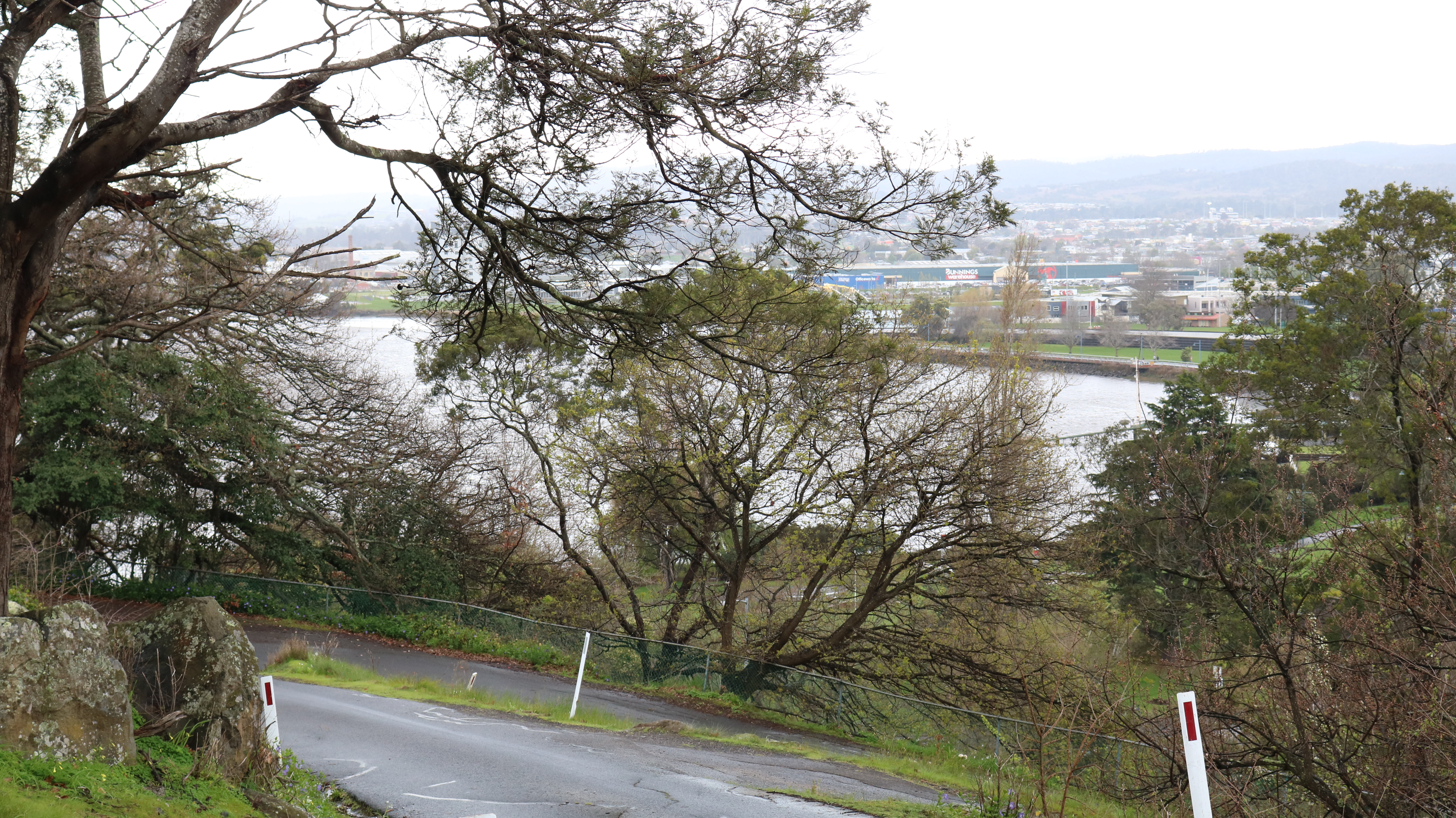
Two photos from a winding road within Launceston which is not used very much, so a view towards the Tamar River for the one above and below the view of the outer area of Launceston on a rainy day.


Wednesday, 26 August 2020

Lake Godon, Tasmania.

After viewing  Lake Pedder in March 2020 we headed around to the Gorden Dam in this remote area of in the South West of Tasmania.  It was raining as one expects it to there.  We last visited in 2014.

A little information on Lake Gordon.
Lake Gordon is a reservoir created by the Gordon Dam on the upper reaches of the Gordon River in south-west Tasmania, Australia. The reservoir was formed in the early 1970s as a result of the dam construction by the HEC. (Hydro Electric Commission) It was the largest and most controversial hydro-electric power scheme in Tasmania.

Lake Gordon has a surface area of 272 km2 (105 sq mi), with storage capacity of 12.5 km3 (3.0 cu mi) of water, the equivalent of twenty-five times the amount of water in Port Jackson. (Sydney Harbour).
Lake Pedder is connected to Lake Gordon through the McPartlans Pass Canal.

 The scenery like below is all around you.


There are 196 steps down to side of the hill to be able to walk across the dam which is wider than it looks, we didn't do it this time due to rain, but don't think I could do it now I'm older.


Below is Seesaw Mountain, not listed on the maps of today. Taken on our way back to New Norkfolk.


Monday, 14 January 2019

Fairbairn Dam, Queensland.

The first photo is of one of the streets in Emerald, the Fairbairn Dam and Lake Maraboon which has changed since our last visit with more work being done as shown in the photos.

Fairbairn Dam is an eathfill-filled embankment dam across the Nogoa River, located southwest of Emerald in Central Queensland.  Constructed in 1972 for the primary purpose of irrigation, the impoundment created byt the dam serves as one the potable water supplies for the region and assists with some flood mitigation.  Lake Maraboon with an active capacity of 1,301,000 ML (2.86 x 10"imp gal; 3.44 x 10" US gal) was formed by damming of the Nogoa River, and, in 2008, was Queensland's second largest dam.  Maraboon is the Aboriginal for 'where the black ducks fly".
Wikipedia

Will be away till after the weekend.  Off in the caravan to the east coast of Tasmania.


Wednesday, 9 May 2018

A Lake and a Dam

Yesterday was a rainy day but the afternoon was alright towards evening, so we ventured to Trevallyn Dam which was built in 1955. A bush drive along the way with plenty of walking tracks.
Picnic areas in different areas and there is no autumn colours as there are no introduced trees in the area.

Bought a new camera last week, have been on three photo shoots with it. 
Got a Canon EOS 750D DSLR this hopefully will compliment my Nikon DSLR 700D which is still ok but getting old.  Always like a challenge when it comes to cameras.
The Canon came with 3 lenses, one tripod and a Canon bag, the deal was too good to be missed.
So I've been out practising with the new Canon..

The dam doesn't look attractive to me but certainly serves a purpose as it provides water for hydroelectricity.


2016 floods with a view of the dam overflowing.


Yesterday's view below taken from the dam across the water to a suburb called Blackstone Heights, Launceston, Tasmania.


The next two photos are of Lake Trevallyn, well I call it that as for researching wasn't fruitful.
The boat ramp is very steep.


A view over the lake.  As far as I'm aware rowing is done on this lake as well as fishing.


Monday, 11 August 2014

Lake Gordon, Tasmania, Australia and the Dam

Lake Gordon is a reservoir created by the Gordon Dam on the upper reaches of the Gordon River in south-west Tasmania, Australia. The reservoir was formed in the early 1970s as a result of the dam construction by the HEC. (Hydro Electric Commission) It was the largest and most controversial hydro-electric power scheme in Tasmania.
Lake Gordon has a surface area of 272 km2 (105 sq mi), with storage capacity of 12.5 km3 (3.0 cu mi) of water, the equivalent of twenty-five times the amount of water in Port Jackson. (Sydney Harbour).
Lake Pedder is connected to Lake Gordon through the McPartlans Pass Canal.

We traveled down to the South West of Tasmania some time ago, these photos were taken then.